Wondering when would be the best time to visit North East? The months starting from March to June are considered to be the best time to visit North East. As these are ever-blooming days ideal for exploring the tribes, trails and teas of this magnificent region.
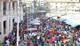
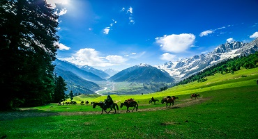
North East India is often referred to as a Kingdom in its own right. And, for a good reason too! The awe-inspiring landscape stands out like a solitary red apple on a giant emerald tree – so unique and special. The best time to visit is from March to June if wanderlust is what you’re craving. These ever-blooming days are ideal for exploring the tribes, trails and teas of this magnificent region. The incredible states of Arunachal Pradesh, Assam, Manipur, Meghalaya, Mizoram, Nagaland, Sikkim and Tripura hardly seem like they are part of India, but indeed we’re proud to call them Indian! With cultures so distinctive and traditions so innovative, the land beckons to intrepid travellers from the world over. From religion to cuisine, spirituality to recreation, there are endless avenues to tread. No matter the time of year, the charming cities, towns and villages of each sister state, continue to excite and thrill locals and foreigners.
So, to help you decide on the best time to visit North East India, we’ve put together a simple guide of its seasons and accompanying weather. Now, you don’t have to waste time and energy mulling over this decision.
Peak Season – If wanderlust is what you’re craving, then North East India during the golden months of March to June is the best time to visit. These ever-blooming days are ideal for exploring the tribes, trails and teas of this magnificent region.
Shoulder Season – October to February
Low Season – July to September
|
Travel Seasons
|
Min/Max Temperature
|
Season
|
|
October to February
|
0-22°C
|
Winter
|
|
March to June
|
10-38°C
|
Summer
|
|
July to September
|
9-35°C
|
Monsoon
|
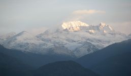
North East in Winter (October to February)
Temperature – The air temperature during the season of winter fluctuates between 0°C and 22°C.
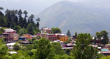
Weather – The weather of North East India in winter ranges from chilly to biting cold, depending upon the State in question. Higher altitude regions such as Arunachal Pradesh and Sikkim drop to sub-zero temperatures, with accompanying snow fall and icy landscapes. Lower altitude regions such as Mizoram and Tripura are blessed with mild winters that exude pleasant temperatures and enable you to navigable plains. In general, this season sparkles with crisp air and a rejuvenating atmosphere.
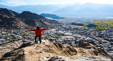
Significance – The season of winter is the absolute perfect time for individuals to explore the quaint mountain villages and country sides of North East India. When blanketed in snow, the plains take on breath-taking beauty like no other. The fascinating tribes, bold culture, thrilling wildlife and blooming flora stand out fiercely. Roing and Tawang, in Arunachal Pradesh, are particularly ethereal winter spots to traverse. With its sacred monasteries and abbeys, amidst spectacular natural sky lines, one may never want to leave!
Highlight Location:
If you adore fresh air, snow-clad mountains, and joyous festivals, winter season is the best season to visit North East with its enchanting sceneries and adventurous activities.
- Dzukou Valley, Nagaland: The frosty hills rolling across the landscape are a dream destination for trekkers, with the best season to visit North East. In search of mind-blowing winter scenery, visit North East at this time of the year.
- Unakoti, Tripura: This rock-cut pilgrimage from ancient times becomes a spooky but enchanting experience in winter and is a great cultural destination.
- Lachung, Sikkim: Photographically perfect white snow-covered peaks and ice-rimmed lakes give this a missing winter getaway experience. Winter has to be the best time to visit North East for snow enthusiasts.
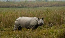
Why you should visit now – Winter is perhaps the best season to visit North East India in, if you’re looking to navigate the national parks and wildlife sanctuaries. In fact, the world famous Kaziranga National Park is especially thrilling during this time. Imagine spotting the one-horned rhinoceroses and Ganges River Dolphin, while the air fizzles with a delicious chill. Safaris are best taken when the atmosphere is cool. Furthermore, this season bustles with colourful celebrations such as the magnificent Hornbill Festival.
Things to know before the visit – The upper regions of North East India experience snowfall in the months of November, December, January and early February. If you’re looking to experience the wonders of this weather, you might want to plan your trip during the former months. However, there is a risk of landslides and road blockages during this time. This season is deemed as shoulder season, with a flood of tourists streaming in. As such, it is recommended that all travel and accommodation be booked well in advance. Expect larger crowds and a general bustle in the air.
Tips – Irrespective of the state you’re traveling to, your attire needs to account for extreme weather. Which means you need to throw in woollen sweaters, vests, scarves, gloves, beanies, socks, a winter jacket and thermals. Throw in some moisturizer and lip balm as you don’t want your skin to shrivel up or dry.
North East in Summer (March to June)
Temperature – The air temperature during the season of summer fluctuates between 10°C and 38°C.
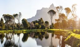
Weather – The climate of North East India during summer is variable. It ranges from cool to scorching, depending upon the region and elevation. While the northern-most parts face pleasant and friendly summers, the lower altitude regions can get particularly hot. All in all, this period is considered to be the best month to visit North East India in, due its crystal-clear skies, amber sunshine and blooming flora!
Significance – From learning about amazing tribal cultures to meditating at ancient temples and tasting traditional cuisine, summer enables diverse experiences. Individuals can be out and about, without the hassles of rain, slate or snow. This is the most ideal season for one to meander along the off-beat paths and trails. Ziro Valley, Jaintia Hills and Dawki River are some of the natural wonders that are especially beautiful during the summer.
Highlight Location:
For sunny skies, flower-filled valleys, and activity-filled days, summer is the ideal time to visit the Northeast, which is best for experiencing its cultural diversity and nature's splendor.
- Silent Valley National Park: Summer is the best time to visit the Northeast for wildlife watching, and this lush rainforest is a secret treasure. It is the ideal time to visit Kerala for those who love biodiversity!
- Gavi: If you’re an offbeat traveller, Gavi’s summer trekking trails and waterfalls will mesmerise you. It’s the best time to go to North East for raw, untouched nature.
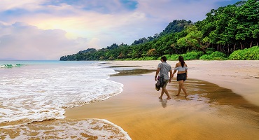
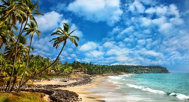
- Marari Beach: Less populated than Kovalam, it's a quiet spot for sunbathing. The early summer season is the best time to visit the Northeast for a quiet beach vacation.
Why you should visit now – The season of summer is conducive for all kinds of adventure sports and thrills. Trekking, hiking, mountain biking, picnicking and kayaking are some of the most exciting activities to engage in, amidst mountains, valleys and endless blue sky. Furthermore, there are vibrant festivals to partake in, that give rare insight into the unique tribal culture.
Things to know before the visit – Summer is deemed as peak tourist season. This means, you’ll be greeted with larger crowds, longer queues and significantly slower service. It’s imperative to make hotel, fight and tour bookings well in advance, to avoid any last-minute obstacles. Also, certain regions experience hot weather during the day, which can get very uncomfortable during sight-seeing trips.
Tips – When exposed to the sun’s rays, especially at high altitude regions, it’s important to take precautions. Sunscreen, sunglasses and a hat/cap are important carry items. When it comes to your attire, light cotton clothing will suffice. However, it’s also important to pack long pants, cardigans and sweaters. Depending on the region you’re visiting, you will need to layer up or shed down.
North East in Monsoon (July to September)
Temperature – The air temperature during the season of monsoon fluctuates between 9°C and 35°C.
Weather – North East India during monsoon is a tropical affair. Rainfall ranges from moderate to heavy, while temperatures vary from hot to cold. The climate is contingent upon the state in question. Higher altitude regions experience chilly weather while regions closer to the equator remain balmy. From stickiness to freshness, monsoon dons many hats. In general, the atmosphere is friendly and the landscapes are lush and plush.
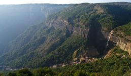
Significance – Regions such as North East India are particularly exquisite during the monsoons. The hills, valleys, lakes, rivers, waterfalls, plantations and forests glisten with emerald beauty. This is a wonderful time to enjoy the tranquillity, serenity and immense beauty of Mother Earth. In fact, Meghalaya is considered to be the world’s rainiest state! Imagine experiencing the magic and mystique of nature!
Highlight Location:
Monsoon changes the area into a paradise of lush greenery, which is the best season to visit North East if you like waterfalls, foggy surroundings, and peaceful retreats.
- Nohkalikai Falls, Meghalaya: India's highest plunge waterfall is at its strongest during the monsoons and is a wonder to see. If waterfalls thrill you, monsoon is the ideal time to visit North East.
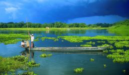
- Loktak Lake, Manipur: The floating phumdis (islands) are enchanting in the monsoon's misty ambiance, making it the best time to visit North East for a full-fledged experience.
- Namdapha National Park, Arunachal Pradesh: This is when the rainforest is at its peak vibrancy, ideal for exotic plant and animal sightings. The best time to go to North East for nature enthusiasts is immediately after the rains.
Why you should visit now – The season of monsoon is a delightful time to enjoy heritage bungalows, boutique hotels and enchanting resorts. Individuals can visit green tea plantations, where they can pick the leaves and drink the delicious concoction too! Furthermore, this period is perfect for relaxing spa days and scenic drives.
Things to know before the visit – It’s important to bear in mind that regions in North East India are susceptible to natural disasters such as storms and landslides. Due to unforgiving and unrelenting rainfall, road blockages may occur and communication can get hampered. Take note of this while planning your itineraries. Also, all adventure sports are inoperable during this time.
Tips- It’s always better to be safe than sorry. Which is why we’d recommend the following things – umbrella, raincoat/windcheater, gumboots/sandals, mosquito repellent, waterproof backpack. Always pack extra pairs of dry clothing and shelter all those electronic gadgets in plastic bags. Lastly, refrain from eating or drinking at unhygienic road-side food stalls.
North East India is a gateway into a wholly different universe. Are you ready to experience the sheer brilliance of one of India’s most unique regions? If you’ve decided your best time to go to North East, look through Thomas Cook’s excellent tour packages!